
Radar Imaging Could Be the Key to Monitoring Climate Change
Cars That Think
JUNE 30, 2023
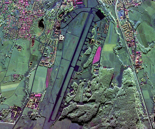
Moreira’s technology also helps to track the effects of climate change. In September 2016 the first global digital elevation map with a 2-meter height accuracy was produced. He presented his first research paper in 1989 at the International Geoscience and Remote Sensing Symposium, in Vancouver.


Let's personalize your content